Geo-Explo is a mapping module integrated into the forum, designed specifically for off-road and heavy-vehicle travelers. It lets you share GPS tracks, bivouacs, points of interest and geolocated photos directly in your posts.
The module is active in every forum of the Travels category. In other categories, posts remain unchanged.
What it enables
- Share GPS tracks (.gpx files) with automatic statistics (distance, positive elevation, min/max altitude, point count)
- Add geolocated spots: bivouacs, water points, trail alerts, viewpoints, rest areas
- Place your photos on the map using GPS EXIF data
- Edit your tracks: crop, cut, merge, rename segments
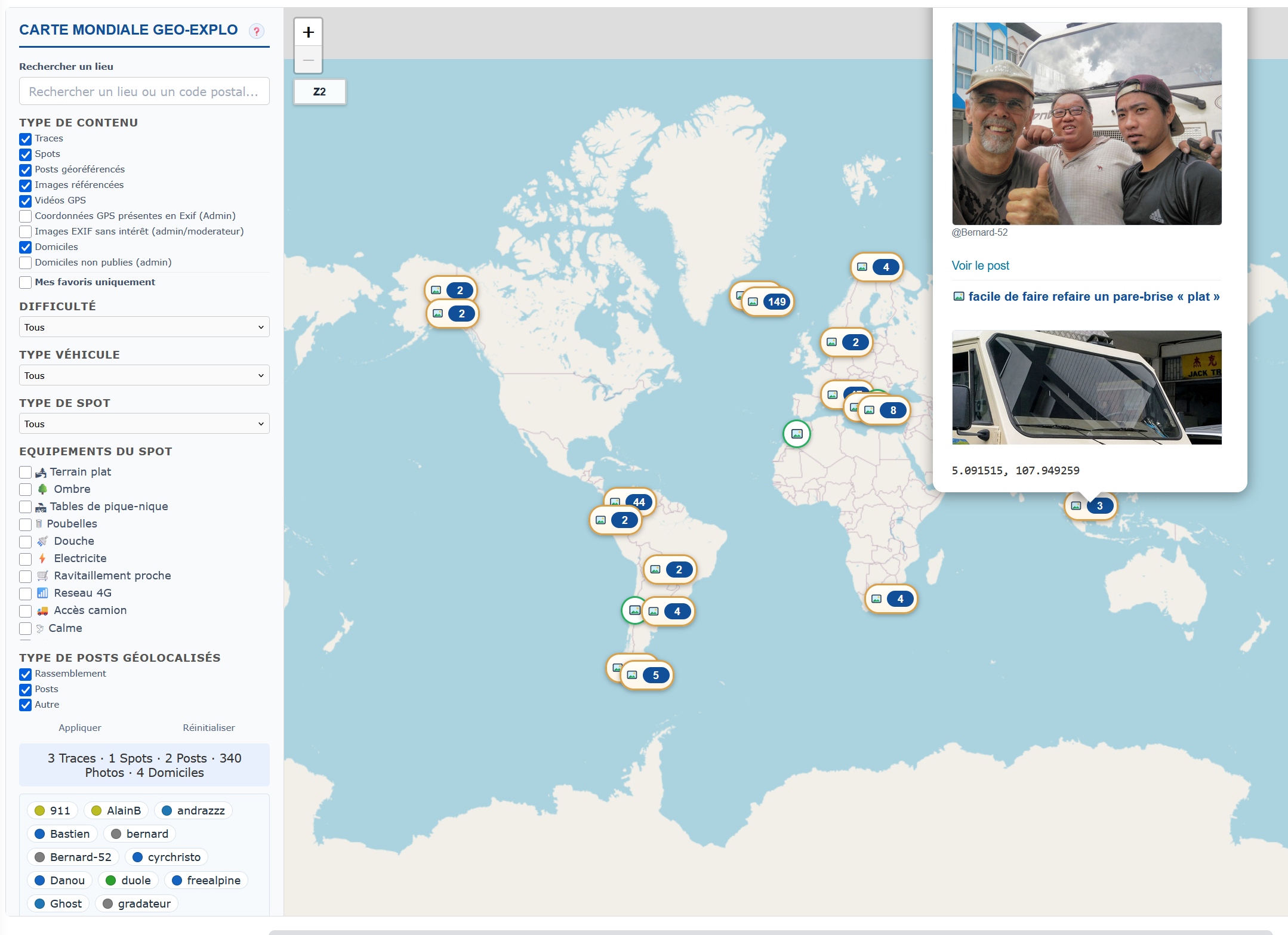
- Explore all forum tracks on the global interactive map
- Save favorite tracks, define private zones, declare your vehicle
Viewing a track in a post
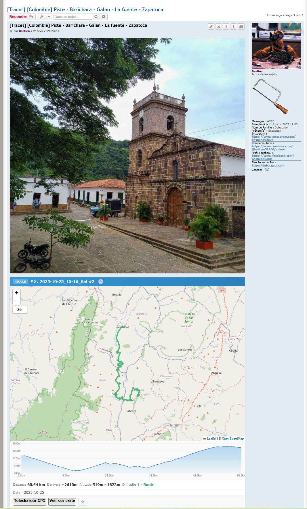
When a Travels-category post contains a GPS track, the interactive Leaflet map and the cover image appear automatically above the post body. Click on the track: a popup shows distance, elevation gain, min/max altitude.
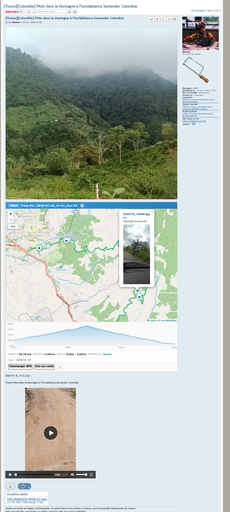
If the track has altitude data, an elevation profile appears below the map, with synchronized hover (a red dot tracks the cursor position on the chart).
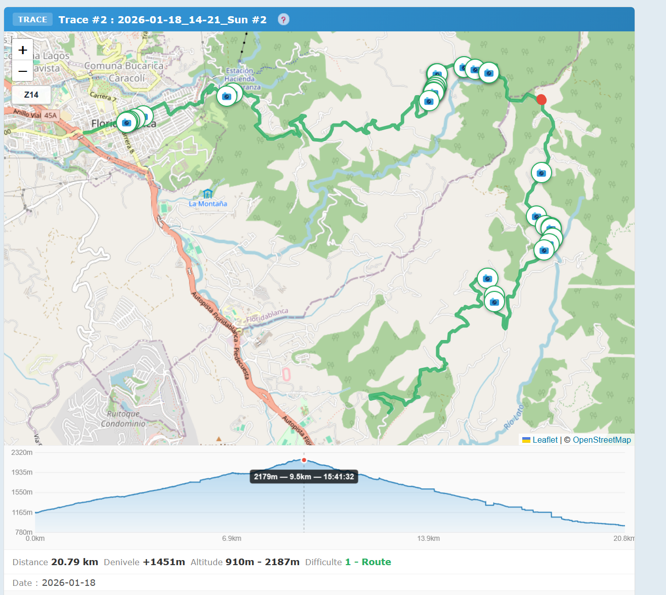
Photos with EXIF coordinates appear as 📷 icons (circular markers) on the map. Below the map, two actions: Download GPX (raw file) and View on the global map (opens the explorer centered on the track).
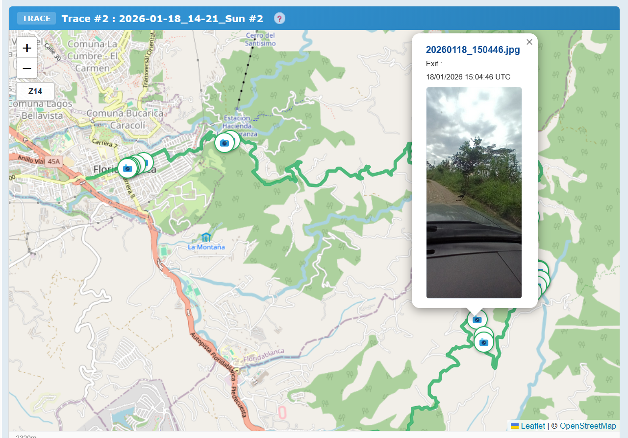
Creating a geo post
Below the text editor, a Geo-Explo panel offers 4 independent and combinable functions.
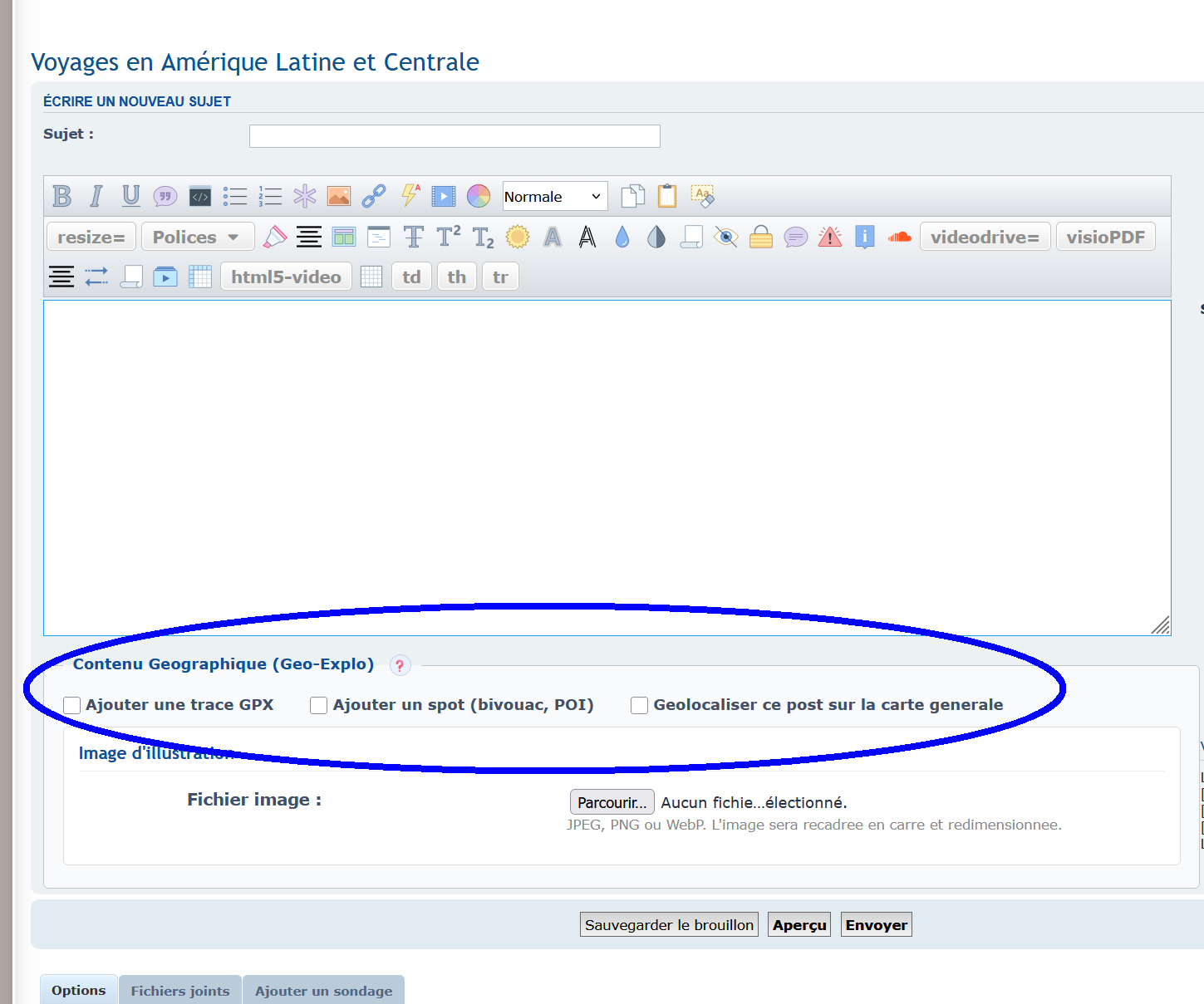
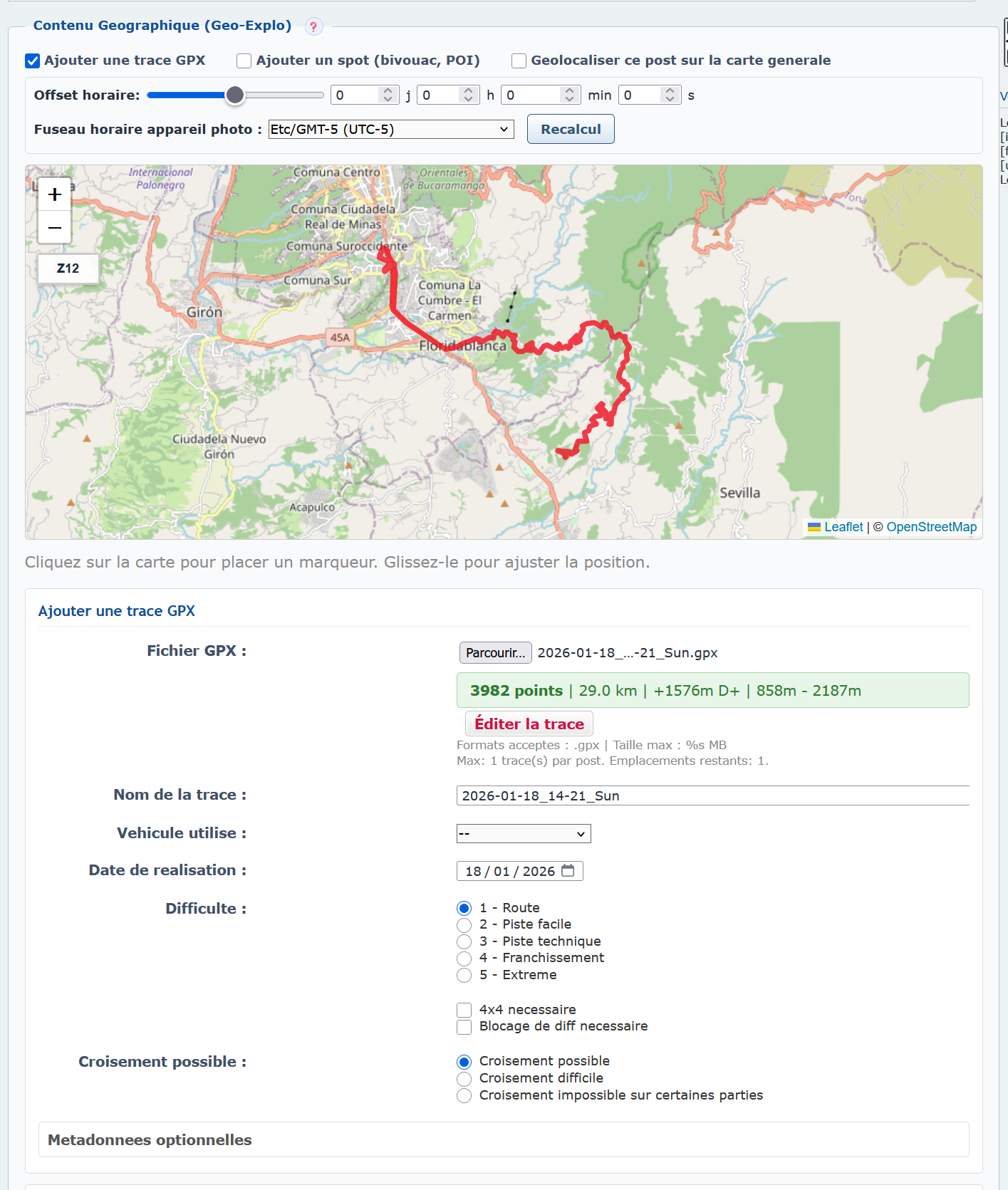
- Add a GPX track — drag-and-drop or file picker. Automatic preview with stats. Douglas-Peucker simplification for display, full original data kept for download
- Add a spot — title, category (Bivouac, Refueling, Trail, Viewpoint…), tags, coordinates (map click or input), description, suitable vehicle types
- Geolocate the post — attach a geographic area to the post itself for explorer filters. Country and region auto-detected
- Cover image — designate one attachment to be shown in track previews
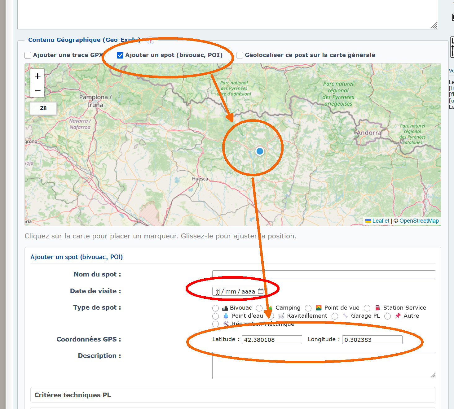
Auto-saving drafts
While composing, Geo-Explo saves the draft on the server (text + geo data + files) every 30 seconds and 5 seconds after you stop typing. Structuring geo events (placing a point, enabling a track) trigger an immediate save. The draft is tied to the account: you can resume from another machine. On reopen, a “Draft from…” banner offers to restore.
GPX track editor
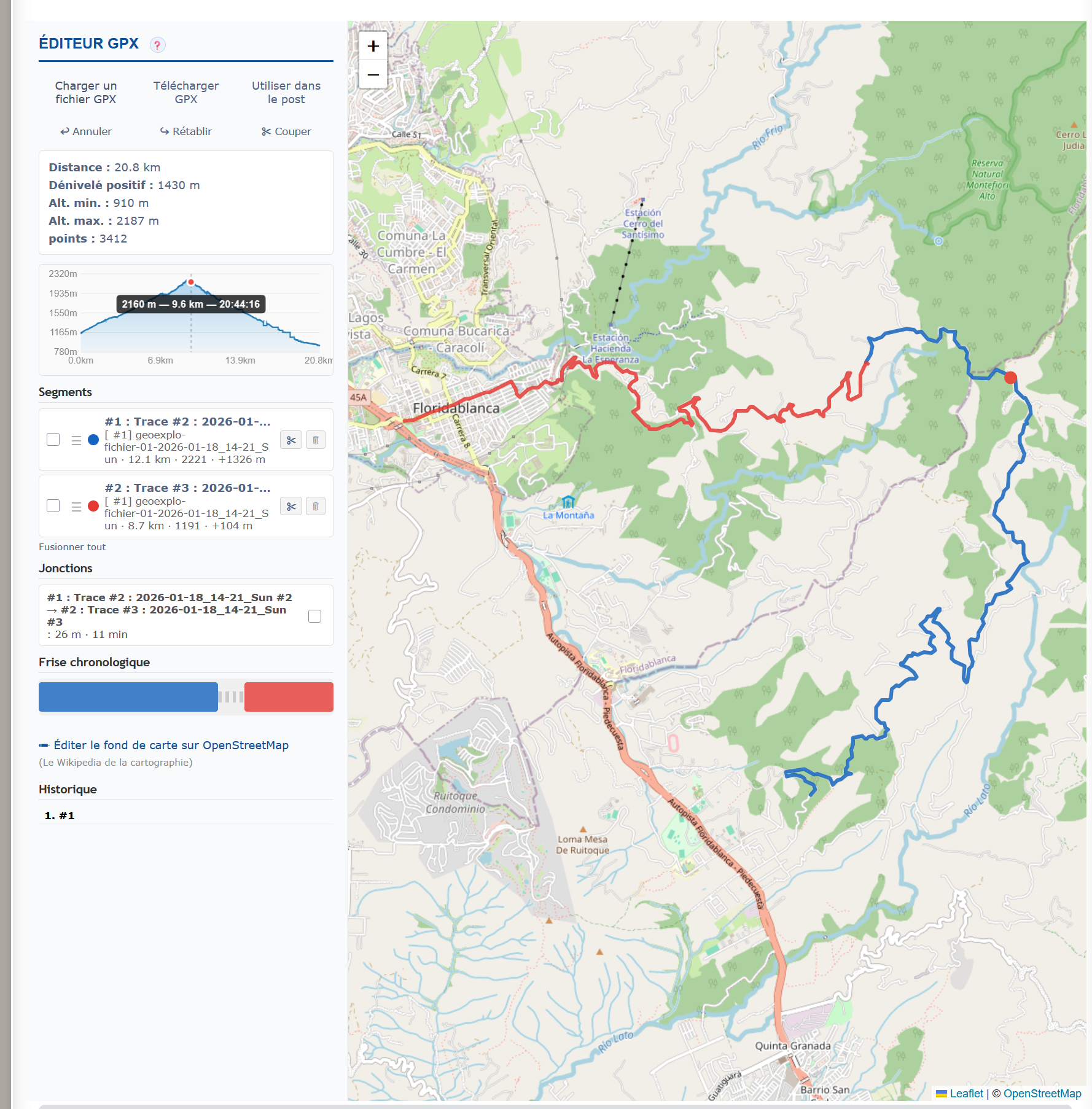
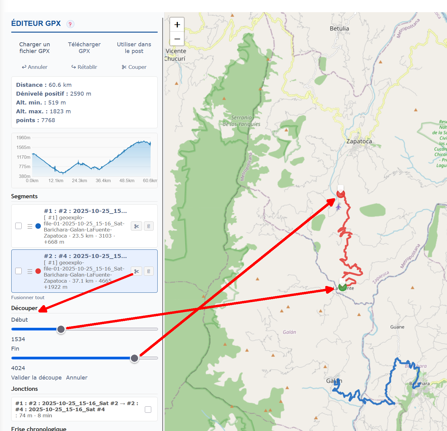
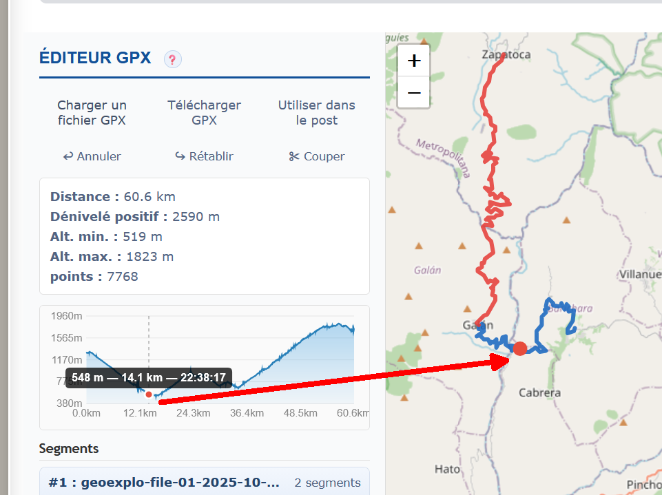
Dedicated editor to process tracks before publishing: load multiple files, segment list, crop start/end, cut a segment, merge two segments, manage junctions, elevation profile, global statistics, timeline, edit on OpenStreetMap, undo/redo, export and send directly to the post form. Keyboard shortcuts available.
Map explorer
Global map gathering every forum track and spot. Filters by country, category, vehicle. Chronological browse to follow the evolution over time.
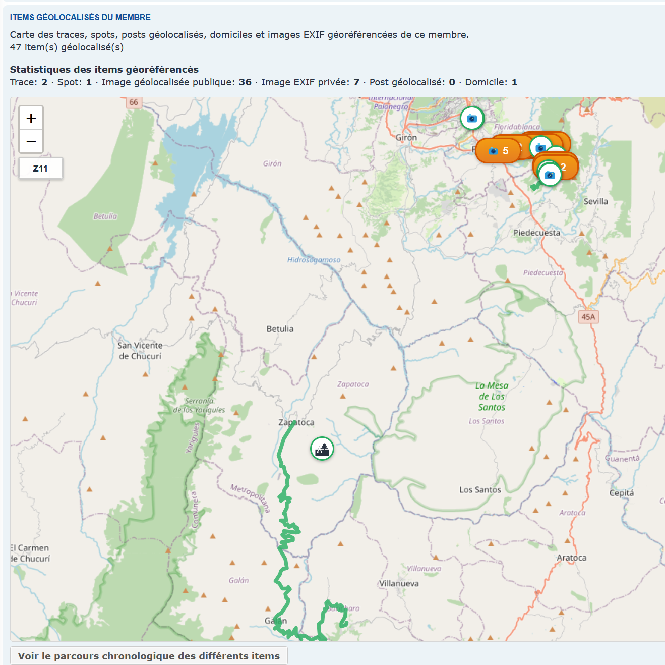
Member geo profile
The user profile includes a map showing the member’s entire journey, with chronological browse.
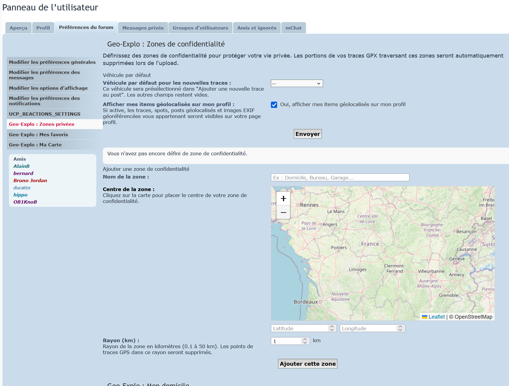
My account
Personal space: favorites (tracks and spots), private zones (map areas where your tracks are only visible to you or a group), home base, current vehicle. Note: the explorer and certain precise data are only visible above a configurable post-count threshold (set by the administrator).
Full documentation
The detailed manual with all 27 screenshots is available on the forum: forum.debucquoi.com/app.php/geoexplo/aide.